Important Information:
The South Yuba River is beautiful, but with potentially hazardous conditions.
The following regulations have been put in place with your safety in mind:
• All alcohol and glass are prohibited everywhere in the park. Violations will result in a citation.
• Dogs are allowed on leash only.
• No camping or fires are allowed.
• For gold panning, the only tool allowed is a metal pan.
• Remember, take only photos; leave only footprints.
Be smart about water safety
• Know the water temperature, current, and depth BEFORE you enter the water.
• Do not exceed your swimming abilities! - Life vests are highly recommended, especially for children.
• Jumping from rocks is discouraged
• diving is prohibited.
MAPS
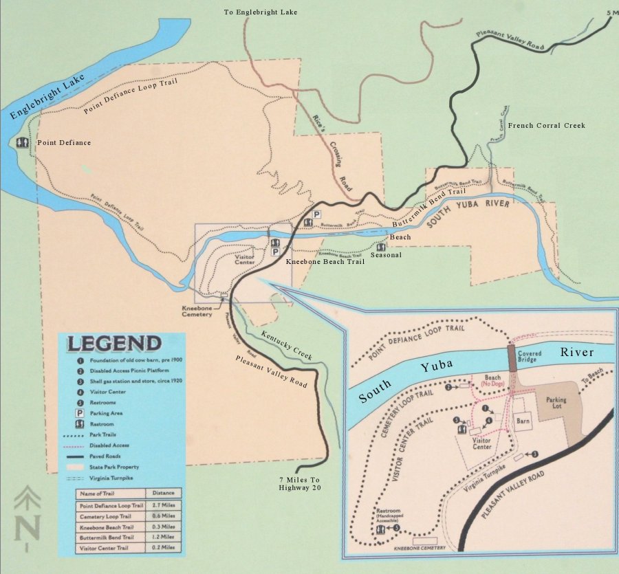
Bridgeport Map
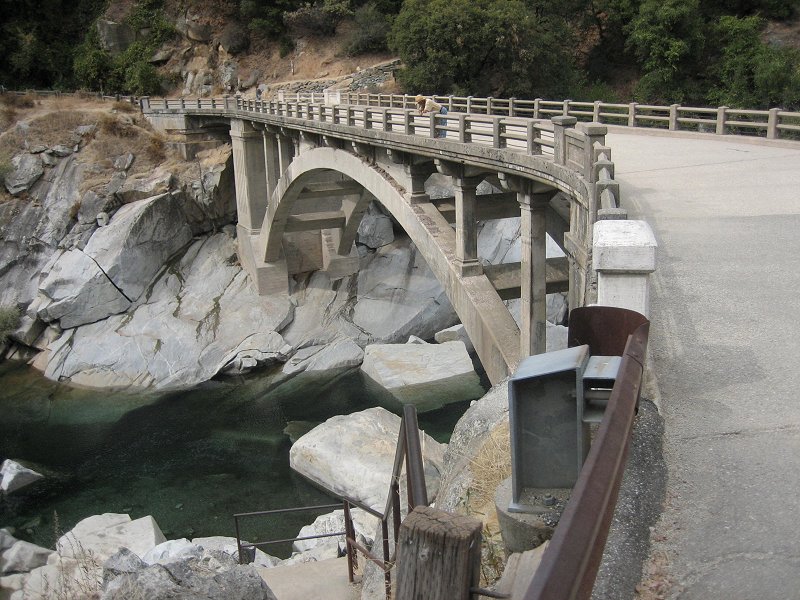
State Park headquarters at Bridgeport includes the Ranger Station, Visitor Center, beaches, trails, and the historic covered bridge, barn, wagons, and family cemetery.
South Yuba River State Park Map
The State Park is comprised of several separate pieces of land, located mainly at and around the bridge crossings of the river. These include Bridgeport, Jones Bar, Highway 49 Crossing, Purdon Crossing, and Edwards Crossing
River Crossings Interactive Map
This interactive Goggle map has photos and information for each of the river crossings.
Bridgeport Trails
Buttermilk Bend Trail
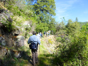
The Buttermilk Bend Trail begins at the north parking lot and follows the north side of the river upstream for a gentle and level 1.2 miles. Scenic river views abound. Don’t miss the springtime wildflower display.
The trail follows the route of the old 1877 Caleb Cooley water ditch, so is mildly sloped and has been made wide enough for wheelchair accessibility.
An upper trail from the parking lot with no severe climbs has been added recently by constructing two new bridges across river tributaries.
More About Buttermilk Bend Trail...
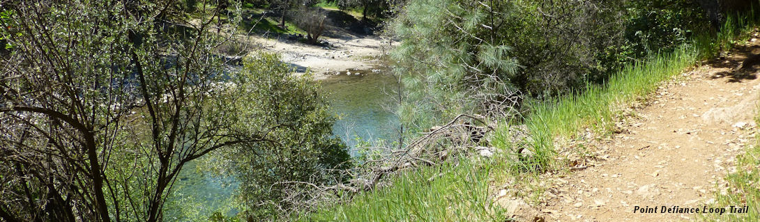
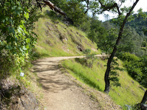
Point Defiance Loop
POINT DEFIANCE LOOP TRAIL HIKES
WHEN: Thursdays: March 15, April 19, May 17
WHERE: The Pt. Defiance Loop Trail begins across from the North Parking Lot
Point Defiance Loop begins at the north end of the covered bridge and continues downstream 1 mile where the river flows into Lake Englebright at Point Defiance. The trail continues uphill with peaceful lake views, then descends through oak woodland back to the bridge, for a total of 2.8 miles.
More About Point Defiance Trail...
For a printable brochure click below.
Cemetery Loop
Cemetery Loop of graves in the Kneebone Cemetery. Located about 1/4 mile from the visitor center, the Loop goes past historic Turnpike rock walls to the Kneebone family cemetery, then along Kentucky Creek to the river and past Family Beach. Good bird watching opportunities are nearby.
For a map and description, click below.
Highway 49 Crossing Trails
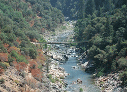
Bridge Over Route 49
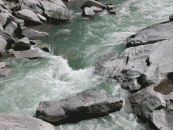
The stretch where the South Yuba River is crossed by Route 49 is a popular area for hikers and advanced river activities. The river is more treacherous here than in other areas of the park and must be treated with great respect, especially during spring runoff.
For expert kayakers,the stretch from here to Bridgeport could be one of the most awesome streches of river to experience.
Independence Trail
The Independence Trail is the nation´s first wheelchair-accessible wilderness trail and follows the path of gold-rush era flumes. From the trail head you can travel approximately 1.5 miles either east or west. Both directions are level and shady, and offer sweeping views from high above the river. From the west trail you can visit Rush Creek waterfall, or take the steep 0.4 mile spur to access the river at Jones Bar. The construction of the Independence Trail was spearheaded by Sequoya Challenge, who maintains the trail and offers interpretive programs.
Hoyt´s Trail
Hoyt´s Trail begins at the north end of the old Highway 49 bridge. It travels upstream about 1.2 miles to a beach and former river crossing called Hoyt´s. Numerous down trails lead off the main trail to small beaches, smooth, water-sculpted granite perches, and pristine swimming holes
Purdon Crossing to Edwards Crossing
South Yuba Trail
This 5 mile stretch of the South Yuba Trail runs along the shadier south side of the river between Purdon Crossing in the west and Edwards Crossing in the east. If you begin at Edwards Crossing, the trail slopes slightly downhill. You will 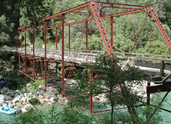 travel through several microclimates - mossy, ferny streams; sunny rock outcroppings; and forested areas - and through State Park, Bureau of Land Management and private properties. The species of springtime wildflowers are those that favor cooler, shadier climates, different from those of the Buttermilk Bend trail. This trail is open to mountain bikes, with some technical sections.
Spring Creek Trail
At Edwards Crossing, the Spring Creek Trail begins at the north end of the bridge. It continues downstream about 1 mile, crossing Spring Creek along the way. At Spring Creek you might be lucky enough to see swarms of lady beetles covering rocks and tree roots in a red carpet. There are several points to access the river along this trail.